
Base match
East and west are separate trailhead decisions.
Hollister and Paicines
Best for the East Entrance, Bear Gulch, and the park's only campground.
Tradeoff: The final drive from Hollister remains rural. A listing outside town may not save time, and summer heat can make an early start more valuable than an amenity.
Soledad
Best for the West Entrance and its Chaparral-side trailheads.
Tradeoff: CA 146 into the west side becomes narrow and steep. NPS warns that RVs, trailers, and large vehicles should avoid this approach.
King City
Best as a Highway 101 stop or southern approach option.
Tradeoff: It is not a direct bridge between the two sides. Confirm whether the planned walk begins east or west before judging its drive.
Trip logic
There is no road through Pinnacles between the gates.
NPS states plainly that no road connects the East and West Entrances. A visit can cross the park on foot by appropriate trails, but the car remains on the side where it entered. The East Entrance holds the campground and Bear Gulch area; the West Entrance reaches Chaparral and has gate-hour and vehicle-size constraints. Cave access can vary, so check trail and cave status before organizing the day around a particular route.
A route sketch, not a road map
Agree on one entrance before the group leaves the cabin.
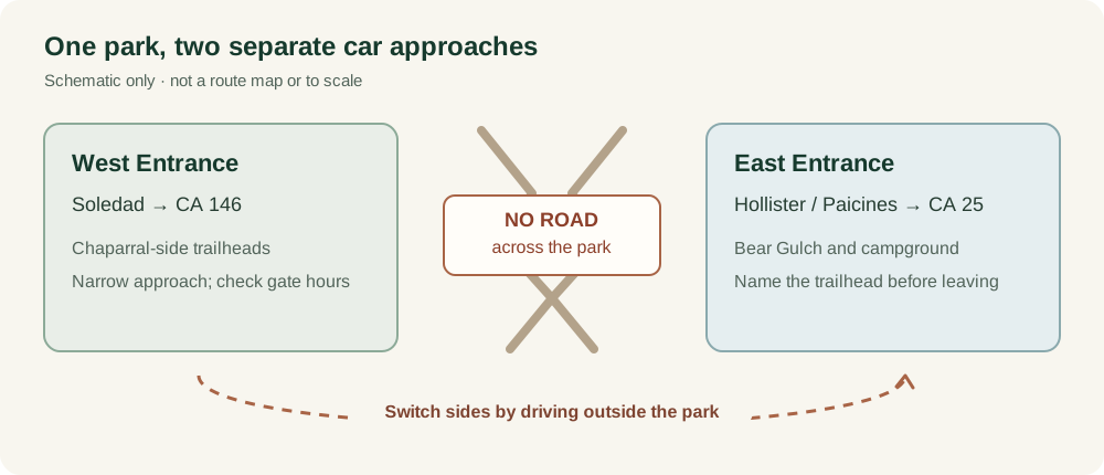
If two cars arrive on opposite sides, the party cannot simply drive through to meet. NPS also notes limited cell service, so send everyone the same entrance and offline map before departure.
Before booking
Name the cave, trail, and vehicle size.
- Which entrance is printed on the route to the actual trailhead?
- Is the vehicle suitable for the narrow west-entrance road?
- Does the group need campground access on the east side?
- Are cave and trail conditions current for the planned visit?
Source note
Gateway details reviewed September 29, 2026.
This is a desk-researched route guide, not a firsthand cabin or park review. We checked access details against National Park Service planning information. Schedules, roads, and operating conditions can change; verify the official pages for your travel dates.
Own a nearby cabin?
Show travelers which park trip your stay supports.
A useful profile explains the real approach, morning drive, sleeping layout, parking, weather access, and nearby services.